Route of the "Riberers" or "Old Route to València"
PR-CV 388
This is the route that was used by the “Ribereros” (Benissa farmhands that walked to Valencia to harvest rice at the Júcar riverside) in their yearly forced emigration. Along the route you can enjoy wonderful views of the Marina Alta, see abandoned farmhouses, walk along the hills known as the Mallà Verda and visit the “Font de la Mata” nature spot.
Length: 4 hours - Distance: 14km - Type of path: circular
Walkability: Moderate
Maximum altitude: 430m
Access: The route starts from the car park in the Municipal Cemetery (at 2km from the centre of Benissa).
Oltà Route
PR-CV 340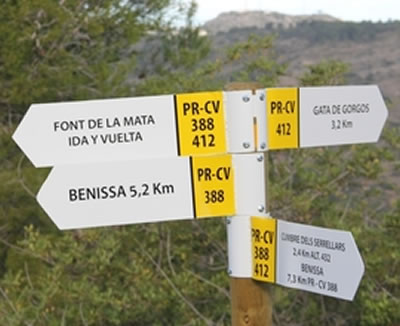
The “Sierra de Oltà” mountain is another of the most loved landmarks of Benissa with its characteristic “dit” (finger) and its isolated aspect
Length: 2 hours - Distance: 7km
Walkability: Moderate
Maximum altitude: 587m
Access: Take the N-332 road towards Alicante. After 9km turn right at the “Calpe Sur” junction and follow the signs to Estación F.C. (Station) and then continue following the signs to “Monte Oltà – Zona de Acampada” (camp site) at approximately 2km.
Bèrnia Route
PR-CV7
La Sierra de Bèrnia is the natural frontier between the Marina Alta and Marina Baixa and its crested ridge is the backdrop that we see as we look south over Benissa. This route passes alongside the Font de Bèrnia (spring), and goes through the “Forat”, a natural tunnel that crosses through the ridge to the southern slopes where the route continues as far as the “Fort de Bèrnia” the fortress that was built during the reign of Felipe II to ward off the Moorish attacks.
Length: 3 ½ hours. Distance: 8km
Walkabiliy: Moderate/challenging
Maximum altitude: 850m
Access: Take the N-332 towards Alicante. After1km turn right along the CV-750 Xaló road and at 300 metres turn left into the CV-749 road following the signs to “Pinos-Bèrnia” CV-749. Continue on this road for 16 km until you arrive at Les Cases de Bèrnia where the road ends and you can park your vehicle and start the walk.
La Solana Route
This trail offers magnificent views of various villages of the Vall de Pop and also the possibility to see typical farmhouses that are no longer inhabited.
Length: 3 hours - Total distance: 12km
Walkability: Moderate
Maximum altitude: 724m
Access: Take the N-332 towards Alicante and turn right along the Xaló road (CV-750) and then turn left after some 300 metres into the Pinos-Bèrnia road (CV-749). Continue for 2,5 Km and turn right up the dirt track marked by some pillars one topped with a sign for “Rafalet”. This track leads up the mountain leading first to the “campo de tiro” (shooting range). Before you reach this you should park your car opposite the small ruins and four olive trees and start the walk.
The Hermitage Route
Another way to get to know Benissa and its natural surroundings is to visit the “ermitas” (chapels) that are dotted round the rural areas: Santa Anna, Pedramala, Lleus, Benimarraig, Benimarco and Pinos. Although the Santa Anna chapel dates back to 1613 most of the others were built during the first years of the 19th Century. Even today they are still in use and during the summer months celebrate the feasts of their respective patrons, this being therefore the best season to pay them a visit.
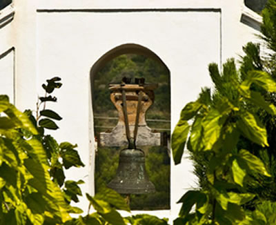
Molí del Quisi Route
SL-CV 136
Very unique route in which you will know some of the functional buildings that show the Benissa old ways. The Pou d'Avall public laundry, where women formerly washed clothes, Santa Anna's Hermitage with its outstanding sandstone façade and the Molí del Quisi, exceptional 15th century hydraulic construction due to its location in a dry geographical area.
Length: 3 hours - Total distance: 8,7 km - Type of path: circular
Walkability: Easy
Maximum altitude: 170 m
Acces: Right in front of the Puríssima Xiqueta church you will find an informative panel from the route, where it starts and continue through La Puríssima street.
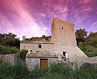
Ways of stone and water
This trail links all the municipalities in the Vall de Pop and reveals the importance of the local ethnological heritage derived from agricultural and rural architecture and linked to the use of water from the river Xalo or Gorgos.
Length: 5 hours 5’ - Distance: 19,5 km
Walkability: Very easy
Steepness: Gentle to very gentle slopes
Access: You can start the trail at any of the municipalities through which it runs. It can also be done in several stages, if you wish, selecting the distances and times to suit.
From Benissa, begins from the Franciscan Monastery.
Town through which the trail runs: Benissa – Senija – Llíber – Xaló – Alcalalí - Parcent – Murla – Benigembla – Castell de Castells.


 Español